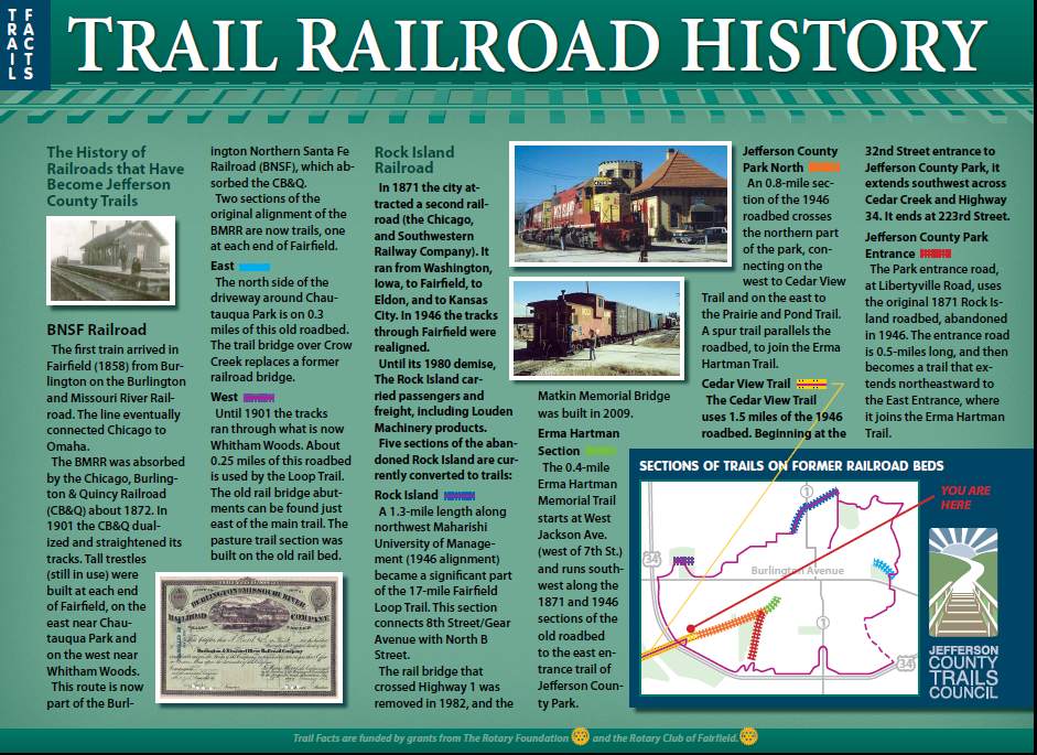
BNSF Railroad History
The first train to arrive in Fairfield (1858) was from Burlington, Iowa, on the Burlington and Missouri River Railroad. Track construction was completed to Omaha, Nebraska, sometime after the Civil War ended.
Also, by this time a railroad bridge had been built across the Mississippi River, allowing connections to Chicago.
The BMRR was absorbed by the C B & Q (Chicago, Burlington & Quincy Railroad) about 1872.
In 1901 the C B & Q dualized and straightened the tracks through Iowa. Tall trestles (still in use) were built at each end of Fairfield, on the east near Chautauqua Park and on the west near Whitham Woods.
This route is now a key part of the Burlington Northern Santa Fe Railroad (BNSF), which absorbed the C B & Q.
Two sections of the original alignment of the Burlington & Missouri Railroad are utilized for trails, one at each end of Fairfield.
⚫ East section -- The "back side" of the driveway around Chautauqua Park is on 0.3-miles of this old roadbed. The trail bridge over Crow Creek (which connects to the Loop Trail) replaces a railroad bridge which was abandoned in 1901.
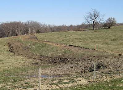
⚫ West section - Until 1901 the tracks ran through was is now Whitham Woods. About 0.25-miles of this old roadbed is used by the Loop Trail. The old railroad bridge abutments can be seen just off the main trail. The section through the cow pasture had to be raised for the trail, but was built on top of the old roadbed and can be seen from Business Hwy 34.
The Chautauqua Park "back side" driveway which was the original roadbed of the C B & Q railroad.
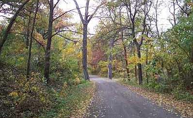
The old C B & Q roadbed, looking toward Whitham Woods. Viewed from Business Hwy 34 West.
Rock Island Railroad History
In 1870 the Fairfield city leaders found out that the Chicago and South Western Railway Company planned to extend its tracks from Washington, Iowa to Kansas City. They lobbied the railroad to come through Fairfield and were successful, and the tracks arrived in 1871.
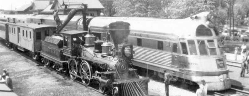
The Rock Island carried freight and passengers to and through Fairfield until its demise in 1980. For some time Louden Machinery Company was the largest shipper on the Rock Island.
In 1946 the tracks were rerouted between Washington and Eldon to create a more direct route. Parts of the roadbed are still visible in and around Fairfield (the rails were removed in 1982).
Five sections of the abandoned Rock Island roadbed are currently utilized for trails (the 1871 and 1946 alignments).
⚫ Rock Island section -- A 1.3-mile section along the northwest border of Maharishi University of Management (1946 alignment) has become a crucial part of the North Segment of the 17-mile Fairfield Loop Trail. This section connects 8th Street- Gear Avenue with North B Street.
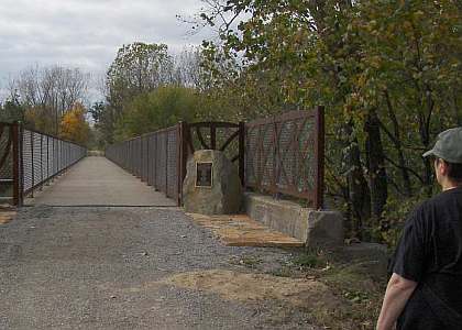
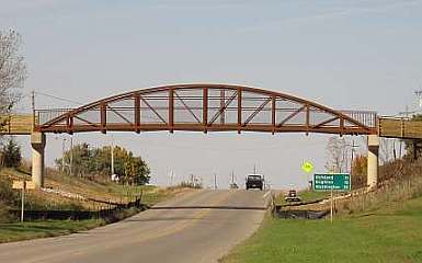
The railroad bridge that once crossed over Highway 1 was removed in 1982, so the Matkin Memorial Bridge was built in 2009 allowing Loop Trail users to safely cross this busy highway.
The new Loop Trail bridge over Hwy 1 which replaces the old Rock Island Railroad bridge.
⚫ Erma Hartman section - The 0.4-mile Erma Hartman Memorial Trail starts at West Jackson Ave (west of 7th St.) and runs southwesterly along the 1871 (and 1946) section of the old roadbed to the East Entrance trail of Jefferson County Park.
⚫ Jefferson County Park section - This 0.8-mile section on the 1946 roadbed crosses the northern part of the park, connecting at its western end to the Cedar View Trail, and at its eastern end to the Prairie and Pond Trail. A spur trail continues, roughly paralleling the roadbed, to join the Erma Hartman Trail.
⚫ Cedar View Trail - The Cedar View Trail uses 1.5-miles of the 1946 roadbed. Beginning at the 32nd Street entrance to Jefferson County Park, it extends southwesterly, crosses Hwy 34, crosses Cedar Creek on the Cedar View Bridge, and ends at 223rd Street. (The old railroad bridge was dismantled in the 1980's).
From 223rd Street the Cedar View Trail utilizes 3 miles of county roads to travel to the town of Libertyville. In the future, the existing railroad bed to Libertyville may be turned into trail, depending on funding and easements.
⚫ Jefferson County Park entrance - The Park entrance road, at Libertyville Rd., uses the original 1871 alignment of the Rock Island (it was abandoned in 1946 when the section to Libertyville was straightened out and shortened). The entrance road is 0.5-miles long, and then becomes a trail that extends northeastward to the East Entrance, where it joins the Erma Hartman Trail.
The new Cedar View Trail bridge over Cedar Creek which replaces the Rock Island Railroad bridge, which was dismantled in the early 1980's.